Starting a Drone Business: Turning an Asset Into Income
Here's a shift in thinking that changes everything: the drone sitting in your closet isn't a gadget. It's an asset — a capable piece of equipment that, deployed correctly, can generate real revenue. Most people who own one never see it that way. They fly it on weekends and let it depreciate. But the same aircraft, pointed at the right work, can pay for itself and then some.
Your Drone Is Already an Asset — The Question Is Whether You Deploy It
Think of it the way a contractor thinks about a truck or an excavator. The machine has value sitting still, but it only earns when it's on a job. A drone is no different. Landowners, builders, real estate agents, solar installers, insurers, and surveyors all need aerial data — and they'll pay for it. The demand is already there. The only thing standing between your aircraft and a revenue stream is knowing how to deploy it professionally.
The Difference Between Flying and Earning
Flying a drone by hand produces nice footage. Producing something a client will pay for takes an automated, repeatable mission — consistent altitude, correct overlap, complete coverage — flown the same way every time so the data holds up. That's not a matter of piloting skill. It's a matter of planning, and planning is exactly where a good tool turns a hobbyist's aircraft into a professional's instrument.
That's Where We Come In
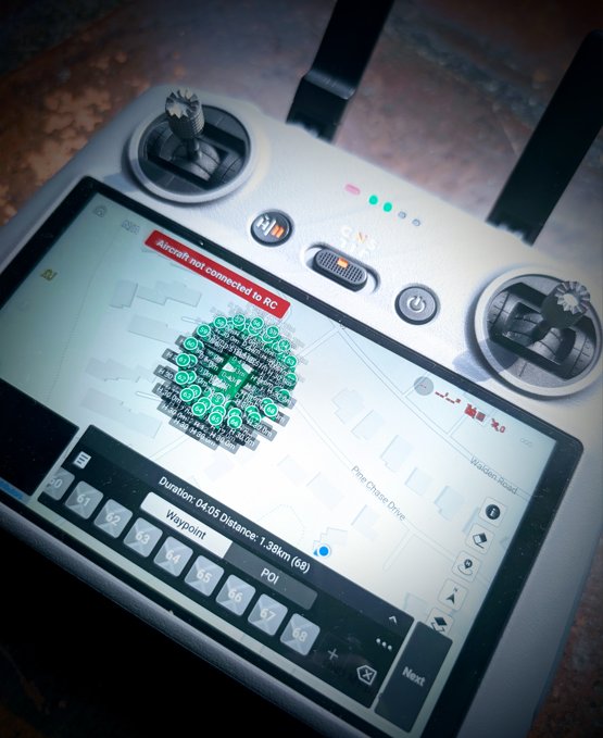
AirPlot is the tool that makes the deployment real. Walk the property with your phone, capture the boundary, and generate a flight-ready waypoint mission — the kind loaded on the controller above — no laptop, no desktop GIS, no guesswork. It's the bridge between owning the asset and putting it to work. Five missions free, no card required →
Whatever the Job, We Help You Help Yourself
The work is more varied than most new operators realize, and your aircraft can do all of it with the right mission behind it:
- Elevation & mapping — topographic surveys, volume measurements, drainage and water planning for land, farms, and job sites.
- 3D reconstruction — detailed models of structures, sites, and terrain for engineering, construction, and documentation.
- Object & asset scanning — close-orbit capture of towers, equipment, rooftops, and infrastructure for inspection.
- Real estate & urban work — clean facade passes and property captures in tight environments where a manual flight won't hold a consistent line.
AirPlot plans every one of these. The mission type sets the pattern, the overlap, and the flight path; you walk the site and fly it. Whatever the deliverable, the hard part — turning intent into a precise, repeatable flight — is handled.
From Photos to a Product You Can Sell
One honest thing new operators should know: your drone produces overlapping photos, not finished maps. Turning those into the deliverable a client pays for — an orthomosaic, a 3D model, an elevation surface — happens in photogrammetry software. The good news is the toolkit is accessible: WebODM / OpenDroneMap is free and open-source and a genuine place to start, with DroneDeploy, Pix4D, and Agisoft Metashape available as you scale into paid, professional-grade tools. A dependable aircraft, AirPlot for planning, and WebODM for rendering is a complete, low-cost starting stack — enough to land your first paying jobs before you spend a dollar on software subscriptions.
Put the Asset to Work
You already own the hardest-to-justify part: the aircraft. Deploying it professionally — planning missions that produce data worth paying for — is the step that turns it from an expense into an investment. We built AirPlot to make that step simple, so you can spend your energy landing the work instead of wrestling with flight planning.
🛸 Deploy your asset — start free. Five complete missions on the free plan, no card, no clock. Plan your first revenue flight this week. Launch AirPlot →