Drone Elevation Mapping for Water Management: How Better Flight Planning Leads to Better Water Harvesting
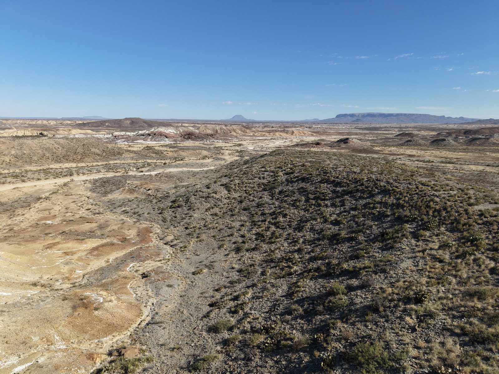
On arid land, water is the whole ballgame. The property in the photo above receives maybe ten inches of rain a year — and when it comes, it comes fast, carves the arroyos you can see braiding through the frame, and is gone in hours. The difference between land that holds that water and land that sheds it is rarely rainfall. It's topography — and whether anyone has mapped it well enough to work with it.
That's what drone elevation mapping is actually for. Not pretty orthomosaics for a listing — a working elevation model accurate enough to design water harvesting around: where to place a berm, which drainage to slow, where a stock tank will actually fill.
What an Elevation Model Tells You That Your Eyes Can't
Walk the land in the photo and you'll see the big washes — they're obvious. What you can't see from the ground is the order of the drainage: which micro-channels feed which arroyos, where sheet flow concentrates before it ever becomes a visible channel, and the two-foot rises that decide whether runoff crosses a pasture or bypasses it entirely.
A photogrammetric survey turns a few hundred overlapping drone photos into a digital surface model (DSM) with elevation values at every few centimeters of ground. From that model, standard GIS tools derive the products water planning actually uses:
- Contour maps at whatever interval the terrain demands — one-foot contours on near-flat land reveal structure that's invisible in person.
- Flow accumulation maps that trace where every drop of a rain event will travel and concentrate.
- Watershed boundaries for each drainage, so you know exactly how many acres feed a given channel — and therefore how much water a one-inch storm delivers to it.
- Cut/fill calculations for pond and berm design, so earthwork gets bid from real numbers.
From Model to Water: What Planning Enables
With a trustworthy elevation model, water harvesting stops being guesswork:
- Berms and swales on contour. A swale dug even slightly off-contour becomes a drain instead of a sponge. Design them from a surveyed model and they hold.
- Check dams and one-rock structures placed where flow accumulation says the energy actually is — slowing water in the small fingers before it organizes into the big erosive washes.
- Stock tank siting backed by watershed math: a tank positioned to catch a 40-acre drainage fills on storms that would leave a poorly-sited tank dry.
- Erosion triage. Comparing surveys season over season shows exactly where material is moving — headcuts advancing, channels widening — while intervention is still cheap.
The Part Nobody Tells You: The Model Is Only as Good as the Flight
Every elevation product above inherits its accuracy from the mission that captured the photos. This is where most first surveys fail — not in processing software, but in the air, twenty minutes into a flight that was planned wrong:
- Overlap is everything. Elevation reconstruction needs each ground point visible in many photos from different positions — 75–80% front and side overlap is the working standard. Thin overlap produces holes and mush exactly where drainages get interesting.
- Consistent altitude, consistent ground resolution. A grid flown at steady height gives the reconstruction uniform data. Freehand flying doesn't.
- Crosshatch for terrain. A second pass perpendicular to the first dramatically stiffens the model on hilly ground like the ridge in our photo — the geometry gets seen from two axes.
- Coverage past the boundary. Models degrade at their edges; a plan that overshoots the area of interest keeps the degradation off your property.
🛸 This is the problem AirPlot exists to solve. Walk the property with your phone, capture the corners with GPS, and AirPlot generates the flight plan — grid or crosshatch, correct overlap, steady altitude, flight-ready waypoint file for your drone's controller. The mission that produces a survey-grade model, planned in minutes from the field. Five missions free, no card required →
A Realistic Workflow for a Ranch Survey
For a section of land like the photo: fly a crosshatch grid at 60–90 meters with 80/75 overlap in the calm hours after sunrise, when shadows are long enough to show texture but not so hard they confuse matching. A quarter-section is a morning's flying. Process the photos in any standard photogrammetry package into a DSM, pull contours and flow accumulation, and walk back onto the land with a map that shows what ten thousand years of storms have been trying to tell you.
Then put the water where it wants to go — and keep it there.